Click on pictures to enlarge.

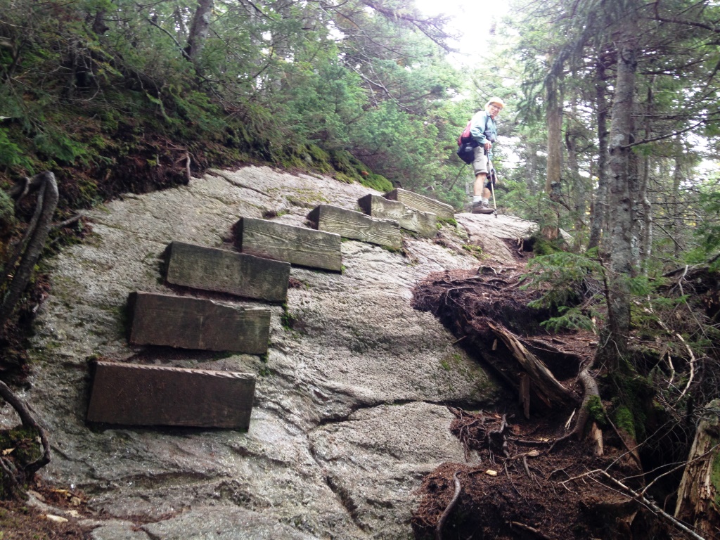
Last time I had done the Wildcats was with Alex in 2010 when he was collecting the 4,000 footers. This time Peter and I started from the Glen Ellis Falls trailhead, up the Wildcat Ridge Trail to go over all the Wildcats (A-E) and down the Nineteen-Mile Brook Trail. The trail starts with the crossing of the Ellis River, which is described in the guide as "difficult and possibly dangerous" but was no big deal. Then the trail started climbing steep right away. It seems like the Wildcats are all rock and really steep. But I was in awe of the trailwork in the building of rock staircases (left) and wood steps to go over steep ledges (right). The wood steps were apparently a popular trail prop in the 1930s, until the purist police decided they were unnatural.I find them very nice.You can also find them on the Fishin' Jimmy and Beaver Brook Trails.
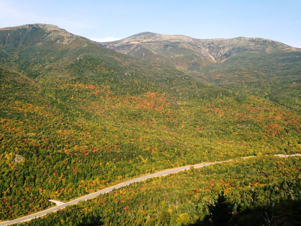

The steep climb also made for a number of views from ledges, across the valley to the Presidential Range (left) and to the south toward Chocorua (right). Skies were turning cloudy.


We got to Wildcat E without fanfare (there isn't even a cairn) and started hearing mechanical noise from the Wildcat skilift bringing tourists up. The top of the lift is between Wildcat E and D. We went by the lift and up Wildcat D where there was a large platform to accommodate the tourists - but the only people going there are hikers because you do need to climb. The platform had great views, as one might expect (left and right).


We continued on the ridge to Wildcat C, B, and finallyA (the tallest one), dipping down to cols and then back up. The trail is very rocky with lots of little ups and downs so the going is not that easy. At the col between D and C there were haphazard bog bridges (left) perhaps because of recent flooding. There were no views until Wildcat A, where a spur trail gives a great view down into Carter Notch (right).
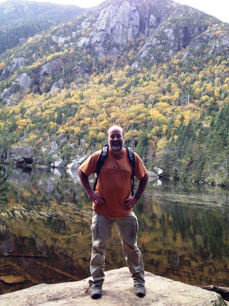
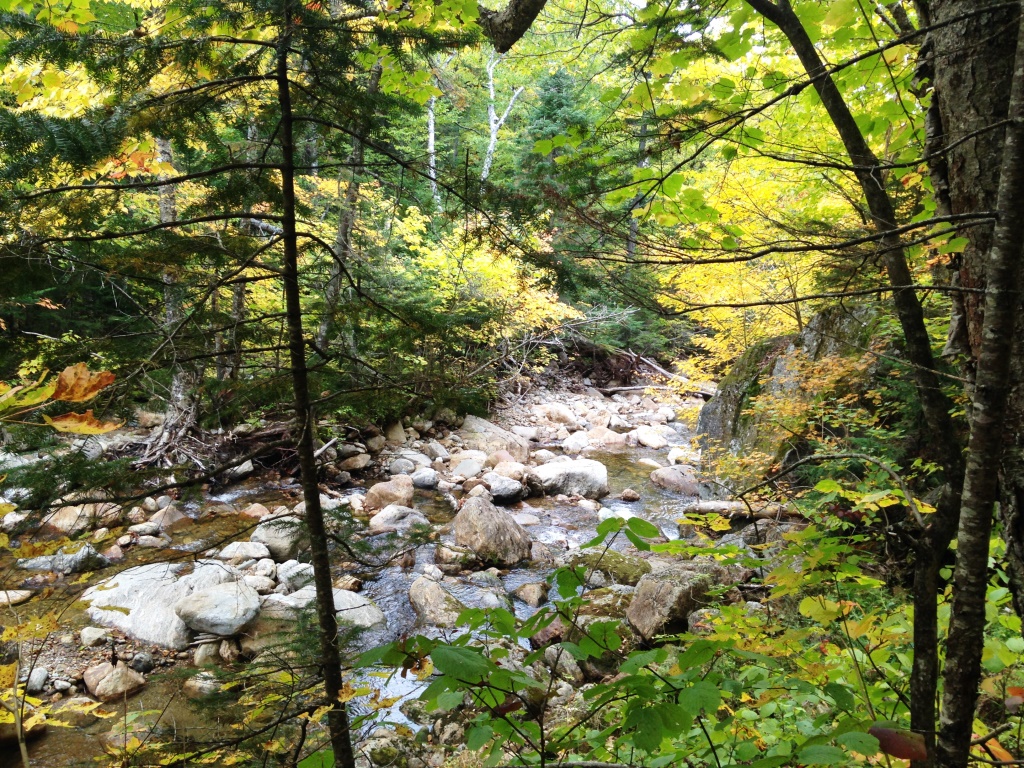
From there we went down to Carter Notch, basically vertical but the trail is a marvel of switchbacks and rock steps so it was really nice and got us down to the notch in no time. I went to pay a visit to the Carter Lakes (left) and caught back with Peter on the descent. Niteteen-Mile Brook Trail was really nice to come down, mostly following the stream and with the early colors adding to the scenery (right).