Click on pictures to enlarge.
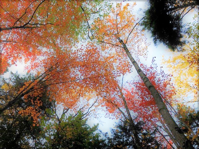

The Percys are prominent peaks just north of the White Mountains National Forest. They can be climbed by a relatively short loop hike but Peter Wyatt and I made a full day of it by approaching them from the east and climbing two other minor peaks along the way. We started from the Bald Mt. Notch Trail. Foliage was at its peak - early because of the drought - and leaves were literally raining on us (left). On the way to Bald Mt. Notch was the skinniest bog bridge I've seen (right).
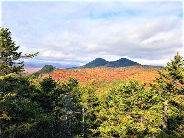

We reached the height of land at the notch and continued down to find an unmarked trail up to Bald Mountain, starting just 0.1 miles before the intersection with the Rowell Link. It's a steep but well-maintained trail and circles the top of the mountain with great views of the Percys and Victor's Head (left) and of Long Mountain on the other side of the notch (right). There were also great views south toward the expanse of mountains including the Mahoosucs, Kilkenny Ridge, and the Presidentials, but the photo I took doesn't do them justice. Bald Mountain is really a gem, and many thanks to the folks who keep up the trail!

Returning to Bald Mt. Notch Trail we continued on the Rowell Link and on to the Old Summer Club Trail (such an unlikely and great name - from the Percy summer club on Christine Lake, founded in 1882!). We took the side trail up to Victor's Head, very steep but not difficult. Victor's Head had closer views of the Percys but those from Bald Mountain were better. A ledge to the south had a great plunging view of Lake Christine and Kilkenny Ridge (left). We could also look back to Bald Mountain and Long Mountain (right).

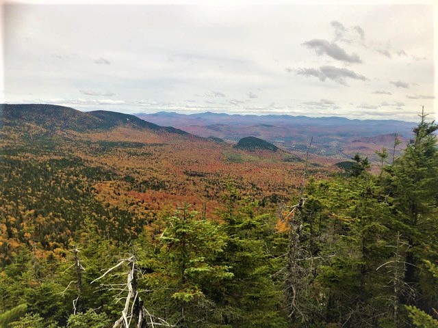
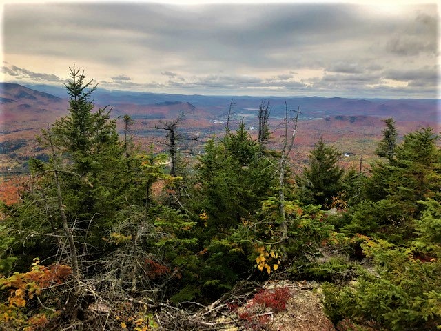
We returned to the Old Summer Club Trail and up to the col between the Percys. The last stretch was steep and rough but interesting, navigating through rocks and cliffs in a very mossy forest. Upon reaching the col we first went up South Percy, which has a very rough and steep unmaintained trail to the top. As we neared the top we had a great view of bare North Percy and of the North Country (left and right).
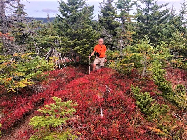
The top of South Percy looks wooded from a distance, but it is in fact quite ledgy. There were views southwest toward Franconia Ridge although kind of hazy (left). There were lots of blueberry bushes in foliage (right).


We returned to the col and climbed North Percy, mostly over steep but not problematic bare ledges. The wind was howling. We could look back on Bald Mountain, Victor's Head and Lake Christine (left) and take in the foliage of the North Country (right). Most prominent were the wind turbines atop the Dixville Notch ridge.
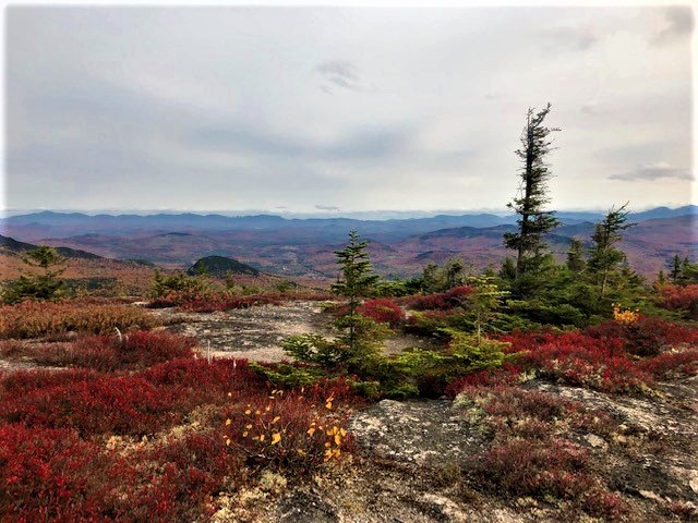
North Percy has a flat open summit covered with blueberry bushes (left and right). It's a beautiful place - you wander around it surrounded by mountains. The foliage made it even more spectacular.


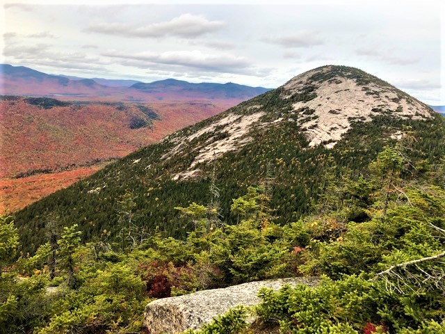
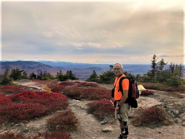
We headed back down, with views of South Percy ahead of us (left), to the col and back on the Old Summer Club Trail to exit at Lake Christine. We got down to Lake Christine close to sunset and it looked like a great place to hang out on a hot summer day - there's a nice beach, no development that we could see, and no powerboats allowed. From there we walked Percy Road back to the car.