Click on pictures to enlarge.

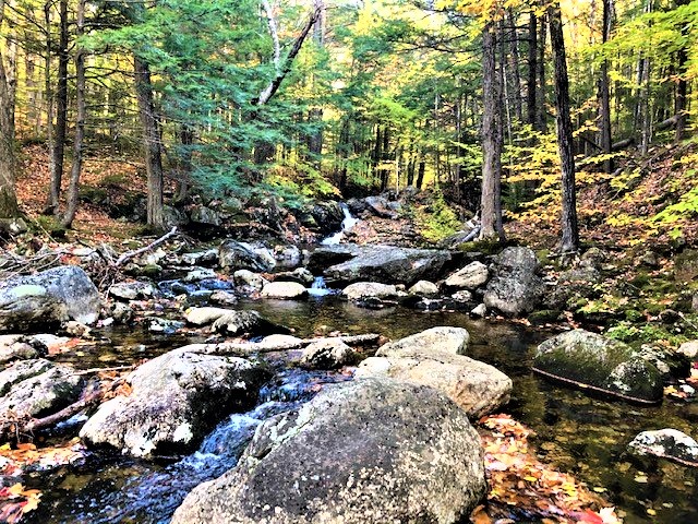
The Royces are in a remote corner of the White Mountains at the border with Maine. To get there we drove through wild and beautiful Evans Notch (left). There was still some nice foliage because of the lower elevation. We went up the Royce Trail, which initially follows and old logging road along the Cold River (right). There were three crossings of Cold River and the first two would have been boots-off were it not for the low water level.
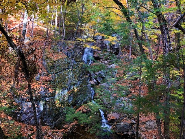

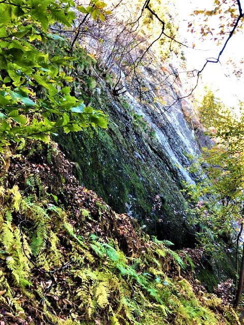
We eventually left the Cold River to go up along the Mad River, which had beautiful waterfalls (left). We continued to the col between the two Royces through beautiful foliage (right).
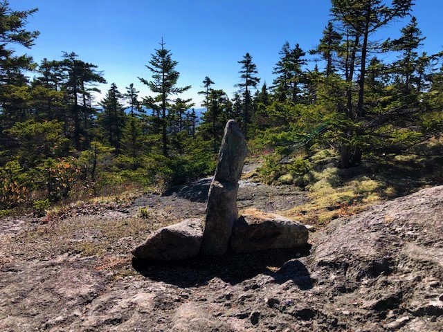

At the col we took the Royce Connector to the East Royce Trail, and up East Royce. By then the mountain was becoming very ledgy, and the trail crew showed unusual fantasy in the design of its cairns (left and right).

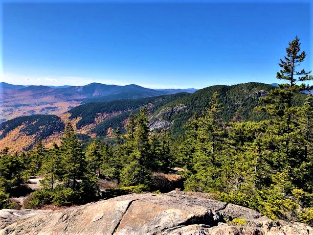
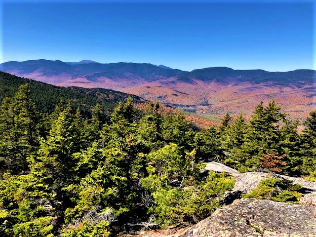
Some of the ledges were very steep and there was some scrambling involved (left). The top of East Royce is a plateau and the trail ends at its south side on big south-facing open ledges, with great views to the south towards West Royce and the Baldfaces (right) and to the east towards the mountains and lakes of Maine.
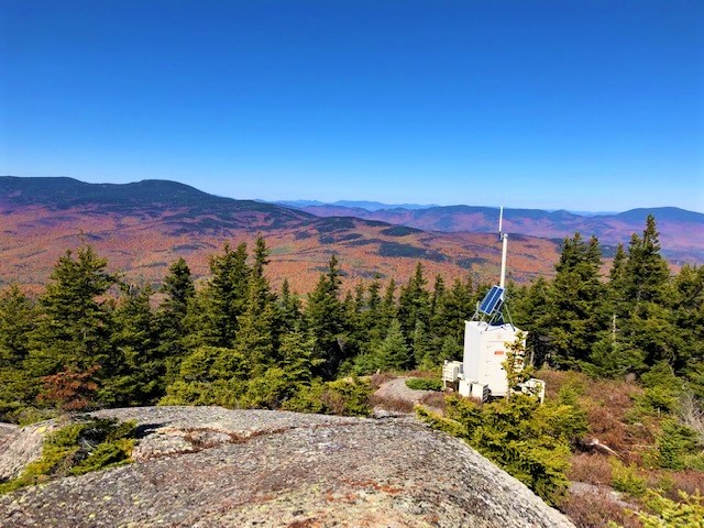
We took an unmaintained trail to the northern end of the plateau of East Royce, over the true summit (viewless) and on to northern ledges where there was an unlikely radio transmitter (left). From that spot we had views north to the Mahoosucs, east toward the Caribou-Speckled Wilderness, and west toward the Presidentials including Mt. Washington sticking out and looking very barren (right).

We went back down the East Royce Trail and on to the Royce connector to return to the Royce Trail heading up West Royce. At the top of West Royce there were ledges with sweeping views to the east (left and right) but the views from East Royce are better.
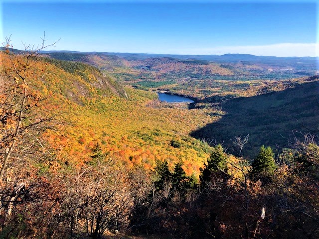
From the top of West Royce we headed down the Basin Rim Trail, which angles toward the Wild River valley and meets the rim of the Basin just north of Rim Junction. From the rim we had fantastic views down to Basin Pond (left). We continued on the Basin Rim Trail beyond Rim Junction for two more outlooks with similar views of Basin Pond. We got back to Rim Junction and headed down the Basin Trail, at first alongside a precipitous cliff (right).

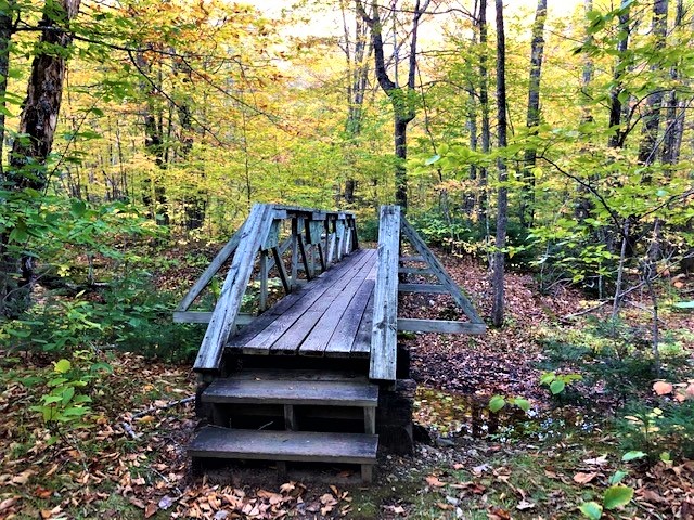
After a while the grade got easier and we emerged in a beech forest, still totally green (left). Peter explained that beeches turn later than other trees. We crossed an insignificant brook on a massive bridge (right) that seemed totally out of place in the middle of the wilderness.
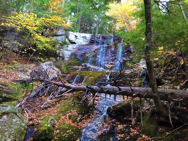
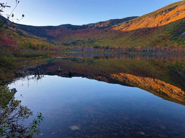
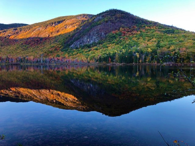
We took the side trip to Hermit Falls (left), which were pretty but would be more exciting at high water. From there we got down to Basin Pond, with gorgeous views and reflections in the evening light (right and below left).
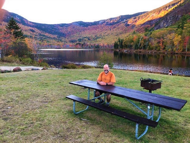
We exited at the Cold River Campground, where Janice and I had camped with the kids 22 years ago before taking them to the Baldfaces. I sat at the same picnic table (right) where we had taken some classic pictures, of course all about the kids. From there it was 1.5 miles back to the car.