Click on pictures to enlarge.
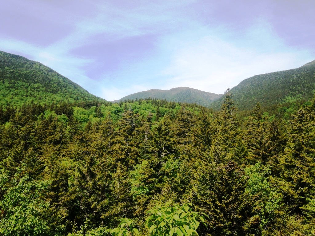
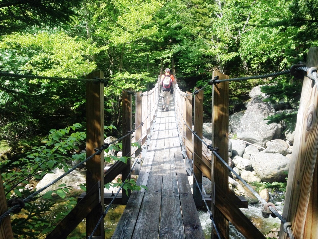
The Six-Husbands Trail is described in the AMC guidebook as "very steep and rough" but that doesn't begin to do it justice. Peter Wyatt and I used it to cross the Presidentials, starting from the Great Gulf trailhead (where Peter's wife dropped us off) and across to the Base Road trailhead where we had spotted my car. The Great Gulf Trail follows the Peabody River into the Great Gulf Wilderness Area and starts off pretty easy amid a network of nordic ski trails. At one point is a big boulder called the Bluff from which you can look up the valley (left). A little further up is a suspension bridge across the river (right), which seems incongruous in the wilderness. That stretch of the Great Gulf Trail is shared with the Madison Gulf Trail and is part of the Appalachian Trail so it has to be in good shape. Eventually the Madison Gulf Trail departs to the left, taking the AT with it.

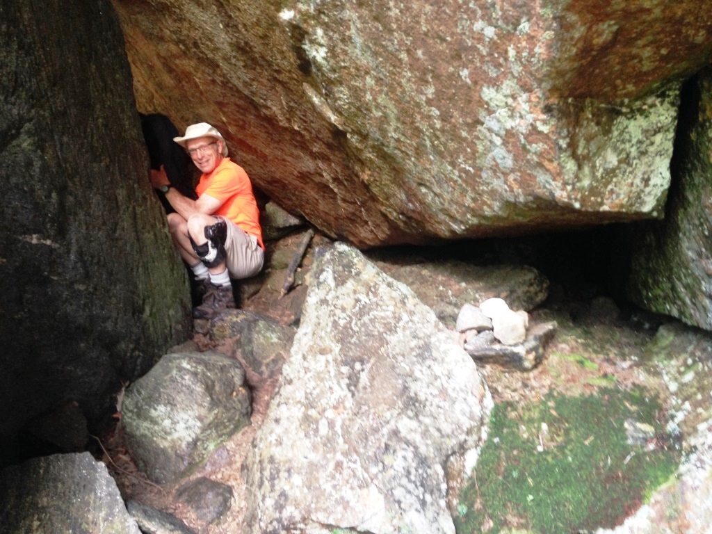
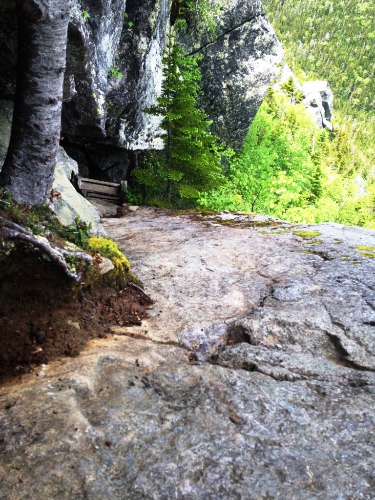
After that the Great Gulf Trail gets significantly rougher as it continues to follow the river, with lots of rocks and roots and mud. At 5.4 miles the Six-Husbands Trail diverges to cross the river. The river level was fairly high and poles came in handy but it wasn't too difficult. From there the trail climbs steeply up the valley wall to Jefferson Knee, a long ridge of Mt. Jefferson. It goes through a number of boulder caves where snow was lingering (left). At one point we had a hard time finding the trail and finally found a small cairn (right) that sent us to crawl through a boulder cave. This being a wilderness area there is little in the way of signs to keep you on the trail, but that was the only confusing place.
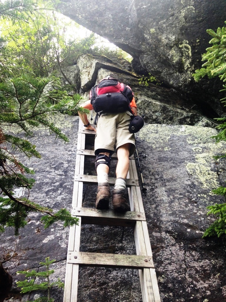

Past the boulder caves we arrived at the famous Six-Husbands ladders to get us over precipitous ledges (left). The ledges are exposed and there is a long fall if you slip. But the ladders are sturdy and well bolted so I had no problem climbing them, just focusing on my hands and feet and not looking down. The third ladder requires some scrambling up a ledge to grab the bottom of the ladder (right) but that was no problem.
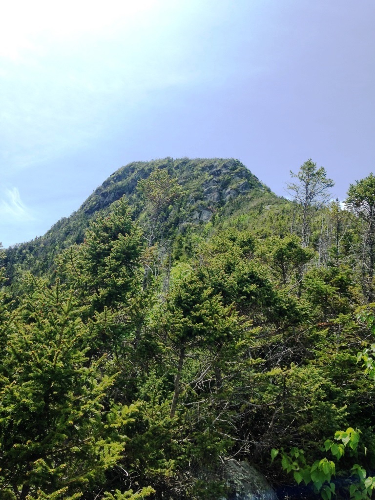
The real scary part is the top of the fourth ladder, where you end on a slippery ledge sloping toward the edge of the cliff for a free fall. The guide says that this spot "could be dangerous if wet or icy" but I suspect it's always wet and slippery. There is very little in the way of handholds or footholds so I found that I had to slowly stand up from the top of the ladder to press my back on the rock behind me and from there propel myself forward to reach some handholds. From there I was able to inch my way from handhold to handhold with nothing but slippery sloping ledge for my feet. Even Peter, who has the genes of a mountain goat, thought that was scary. It was as scary as anything I had encountered on Huntington's Ravine. I was really shaken. I took a picture of the ledge looking down (left) but I don't think the picture does it justice. From the top we could see Jefferson Knee towering above us (right) for what still would be a challenging climb.
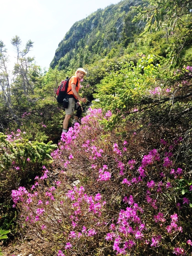

Indeed the trail continues to be a steep succession of ledges all the way up to the top of the Knee. The guidebook calls this part of the trail "moderately difficult" but I would take out "moderately" because it's all hands and feet, with some exposure and some search for hand/footholds. Fortunately we were getting above treeline so the rock was dry and the shoes had a good grip. Rhodondendrons in bloom were beautiful (left). We crossed a solo hiker going down (first one we'd seen all day) - the guidebook warns about not going down this trail but he seemed to know what he was doing. Finally we got to the top of the Knee with superb views all around including back over the Gulf (right).
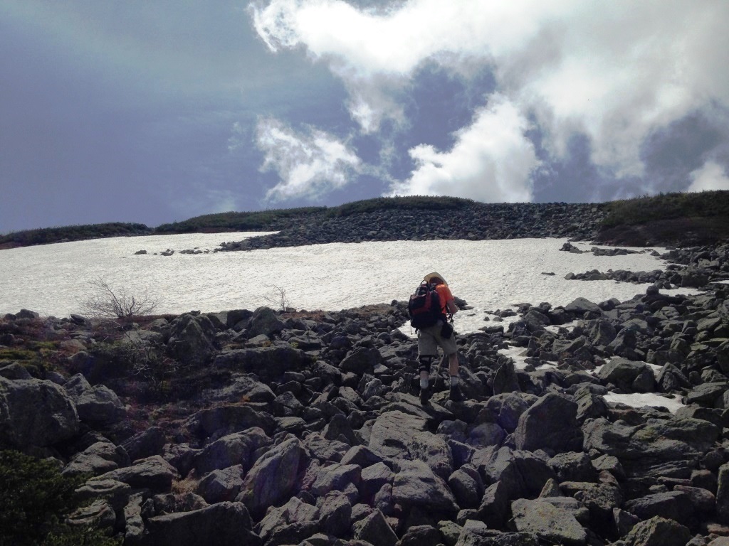
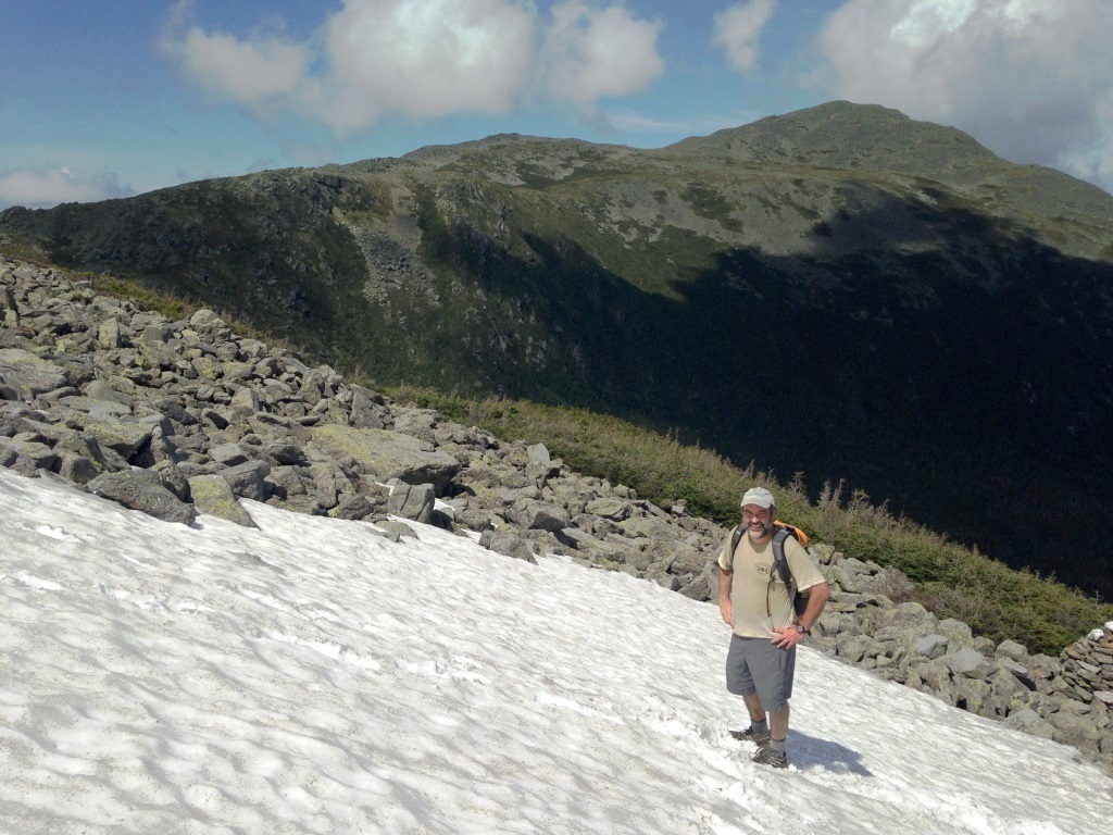
By that time I was totally pooped, largely because of the mental drain from the exposure. I was grateful for Peter's trail mix to refuel. Looking up was a big snow field (left), known for persisting into July. Here I am climbing it with Mt. Adams in the background (right).
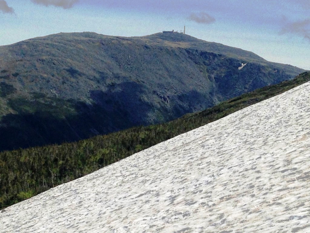

From the snow field there was a great view toward the Gulf headwall (left), where only a few patches of snow remained. There was also a great view looking back to the Jefferson Knee, the lower Gulf, and the Carters (right). We searched for a view of Spaulding Lake, nestled near the base of the Gulf headwall, but could not see it - it seems that the only place from which it can be seen is from the lower peak of Mt. Clay.

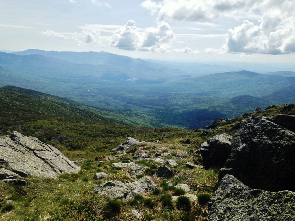
Above the snow field we soon met up with the Gulf Slide Trail, and that was our second encounter with the Appalachian Trail. The Gulf Side Trail follows the Presidential ridge (left) and can be quite busy on summer weekends but today we hardly saw anyone. As we crossed over to the other side of the ridge we had great views to the west (right). We dropped into Sphinx Col, then back up to catch the Jewell Trail, and sped down the Jewell Trail to Base Road.