Click on pictures to enlarge.


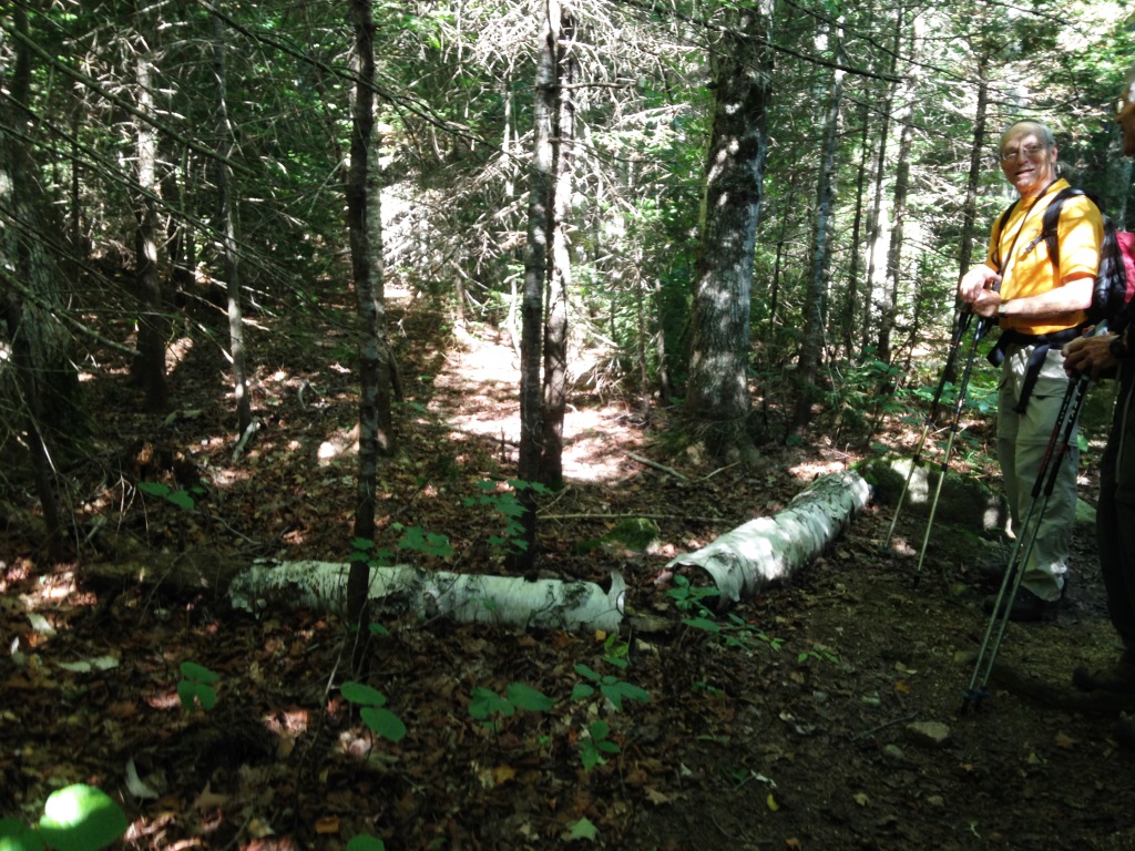
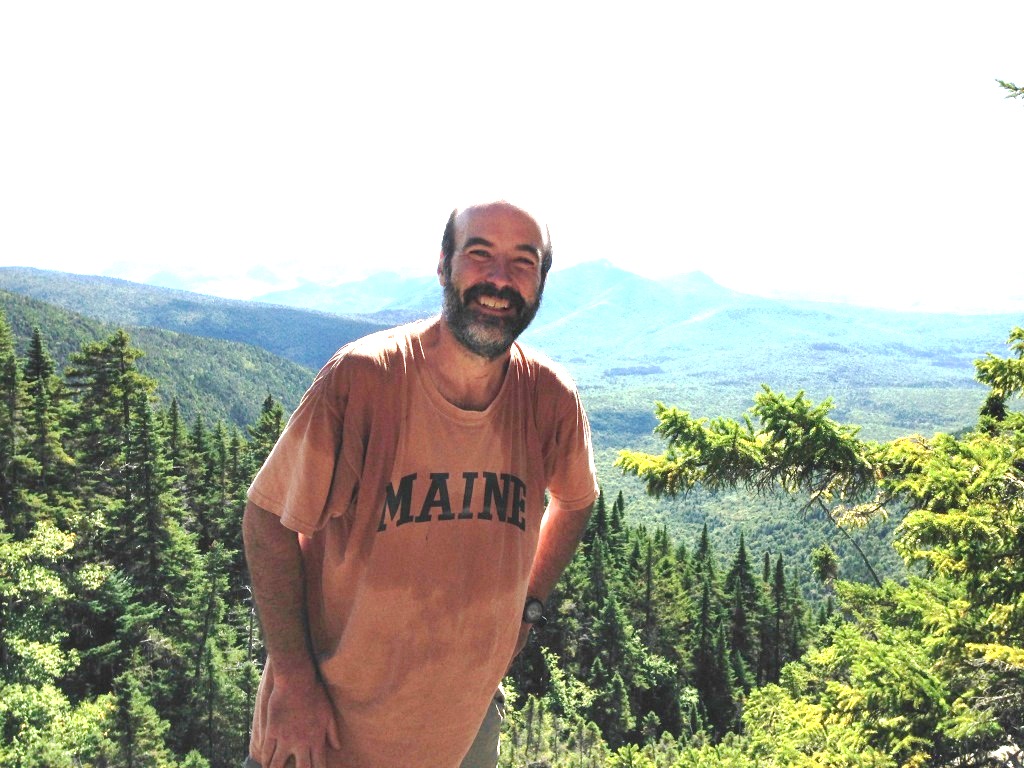
Vose Spur (3,862') is a trailless shoulder of Mt. Carrigain that is on the list of New England's 100 highest. Peter Wyatt and I had tried to climb it earlier in August but had been stymied by an impassable cliff. This time we were better prepared. I had found a handy topo map on the web that showed the route (left). The start of the bushwhack, which we had previously missed, is the so-called "Bushwhack Rock" located at 2,190' well below the height-of-land on Carrigain Notch Trail. The rock was unmistakable once we knew what to look for and at what altitude (right). At the rock we met a solo hiker (Jerry) doing the New England 100 and wondering where to enter the woods. We offered him to join us, which he was happy to do.
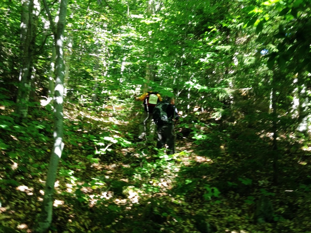
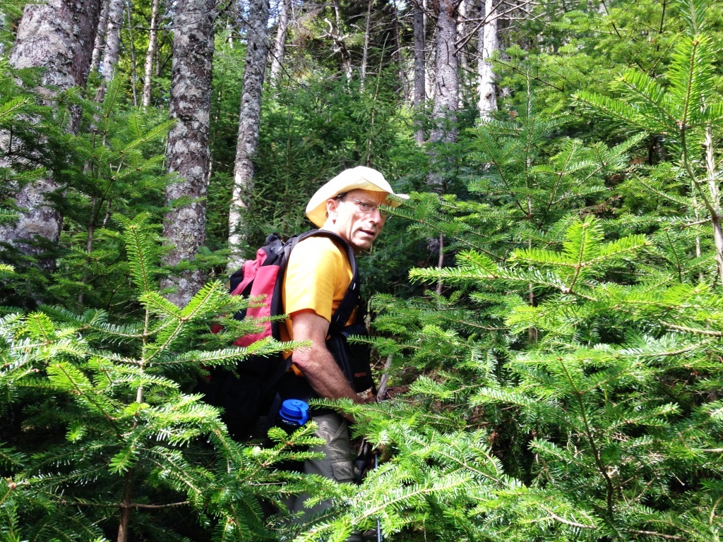
We continued for 35 yards past Bushwhack Rock on Carrigain Notch Trail and found a promising herd path into the woods (left). We started climbing but soon lost it because of blowdowns and generally poor definition. Previous reports had noted this disappearance of the herd path so it didn't bother us too much. We kept going in a WNW direction and it wasn't too difficult - there were frequent blowdowns and the climbing was steep but the woods were fairly open (right). We knew to look for a ridge at which point we would angle more NW (see topo map).

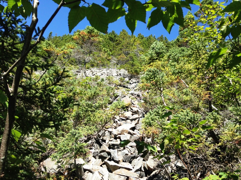
At 2,900' we finally found a very well-defined herd path that took any guessing out of the climb (left) and after that the going was much easier. This also gave us confidence that we wouldn't miss the talus field that is a prominent feature of the bushwhack and provides views as well as ease of climbing. Indeed the herd path delivered us right to the base of the talus field at 3,300' (right).

I would have expected the talus field to go straight up but instead it angled to the right (left). Hiking reports warned of loose rock but I thought it really wasn't bad, and using hands and feet we climbed without much effort to the top of the talus at about 3,600' (right).

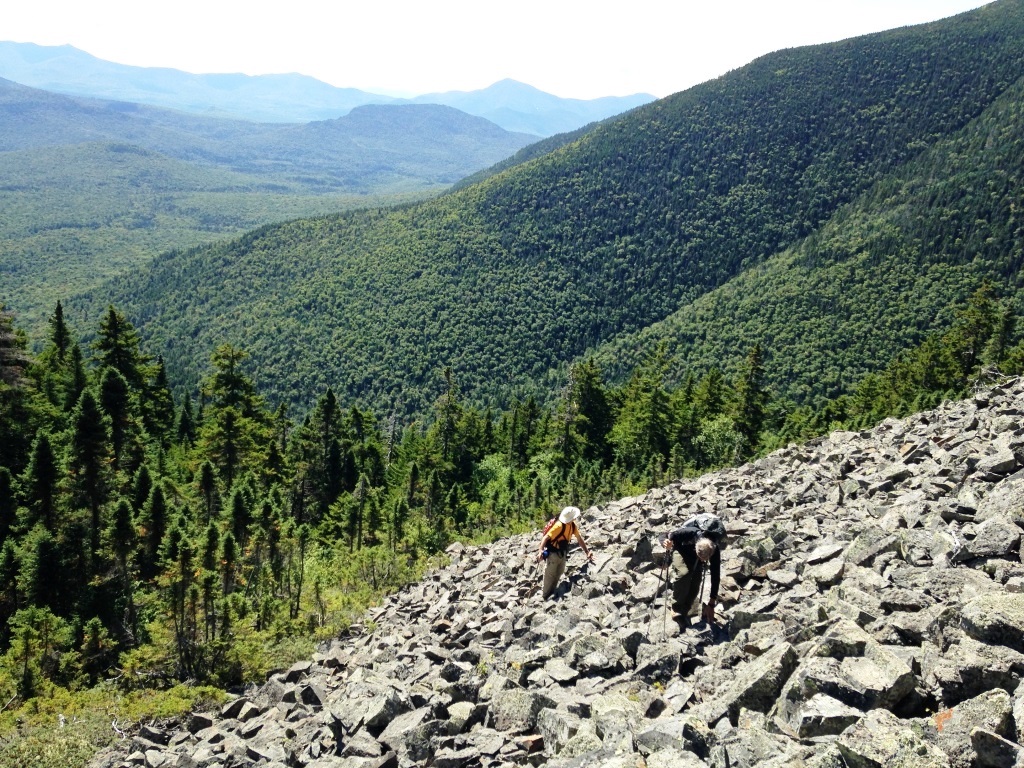
From the talus we had great views looking southwest to Passaconnaway, Tremont, and Chocorua (left and right), but we couldn't see Mt. Lowell across Carrigain Notch - it was hidden to our left. That was rather different from our previous failed ascent of Vose Spur from the Carrigain Notch height-of-land when we had as consolation prize some excellent views of Mt. Lowell. While taking in the views at the top of the talus we heard a shout in the woods above us, shouted back, and soon a lone hiker emerged - he was also doing the New England 100 and was glad to have heard us so he could find the talus. Jerry and he were the only two people we saw all day, and we got to learn a bit about the challenges of doing the New England 100.

From the top of the talus there was another obvious herd path taking us through the spruce (left) and we easily followed it to the top of Vose Spur. As we got close to the top the trail leveled off and became more indistinct, and we soon got to the well-defined top. At the top there was a canister, a sign, and a folding chair! (right). No views though.

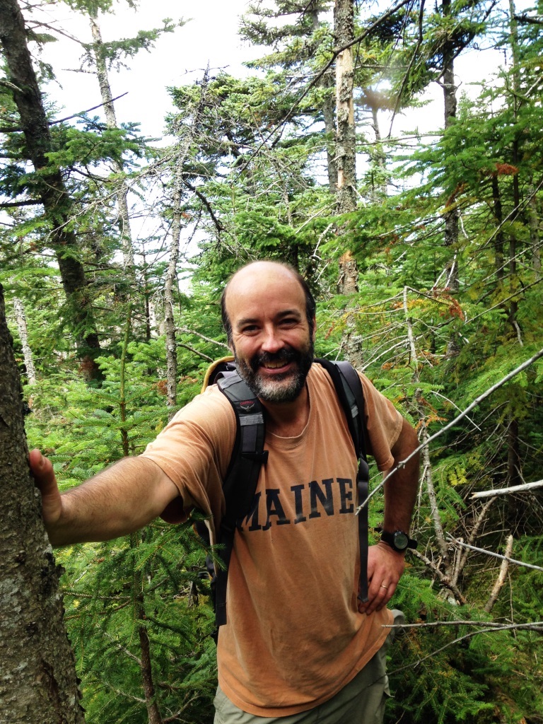
Climbing Vose Spur had been easier than we had expected thanks to the well-defined herd path. So we decided to try a continuation to Mt. Carrigain that I had read in some trip reports. Jerry declined to continue and headed back, while Peter and I dropped into the col between Vose Spur and Carrigain. However, we found the going to be extremely tough through thick spruce - no sign of a herd path whatsoever. We dropped 200' to the col and stared at another talus field ahead of us (left) but the spruce ahead seemed thick and steep. We decided that this would continue to be very slow going and going in this manner all the way to Mt. Carrigain (4,800') would be no fun. So we headed back, after taking a picture at our final point (right). We got back to the top of Vose Spur 45 minutes after we left it and started to go down but had a hard time finding the herd path. We should have made careful note of its location on the ascent - let this be a bushwhack lesson. After some exploration we finally found it, got back to the talus where the wind had died and we were greeted by black flies but fortunately they didn't bite. Going down the talus was no problem and we picked up the obvious herd path at the bottom. This brought us down to 2,900' and at that point it petered out but the woods had become pretty open so we just kept heading down in the SE direction and eventually came out of the woods and on Carrigain Notch Trail at exactly the same location that we left it.