Click on pictures to enlarge.

I had wanted to climb Mt. Davis for a long time. It's in the middle of nowhere, gets no attention because it's not a 4,000 footer, but the AMC guidebook describes it as "one of the best views in the White Mountains" I managed to interest Peter Wyatt in going to check it out with me. To make it more interesting we climbed the Davis Path along the whole Montalban Ridge, descending by the Ammonoosuc Ravine Trail. Peter's wife Nancy dropped us off at the Davis Path trailhead (1,000 feet) at 6:20 a.m. and up we went. Our first stop was Mt. Crawford (spur trail from Davis Path), which at just 3,100 feet does have one of the very best views in the Whites. The early morning light made it even more spectacular. See this northeast view towards Stairs Mountain and the southern Presidentials (left) and this northwest view up the Saco Valley to Crawford Notch. See more pics from Mt. Crawford in foliage from my previous hike to Stairs three years ago.


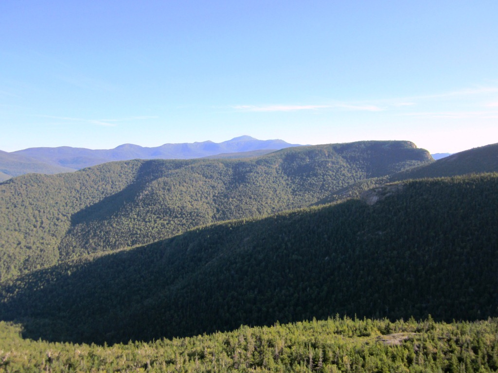
We descended back to the Davis Path (left) and headed for our next stop at Mt. Resolution. The trail ran on wonderful ledgy terrain with lots of views. We took the side trip to the ledges of Mt. Resolution for more fantastic views including back to Mt. Crawford (right) and a closer look at Stairs (below left).
From there we continued on to Stairs Mountain, following the Montalban ridge, and dropping into Stairs Col (right). The col had a profusion of vegetation that gave it a very wild look. At that point the Stairs Col Trail diverges and we followed it briefly to the height of land to see if there were any views but they were none. So we got back to the Davis Path and climbed the "bold zig-zags" to the "inspiring views" of Stairs (sic. AMC Guide - the writer had gone lyrical). It is indeed unusual to find switchbacks in the White Mountains, where the trails mercilessly send you straight up steep rocky slopes. But the Davis Path was built for mules, who are more discriminating about footing.
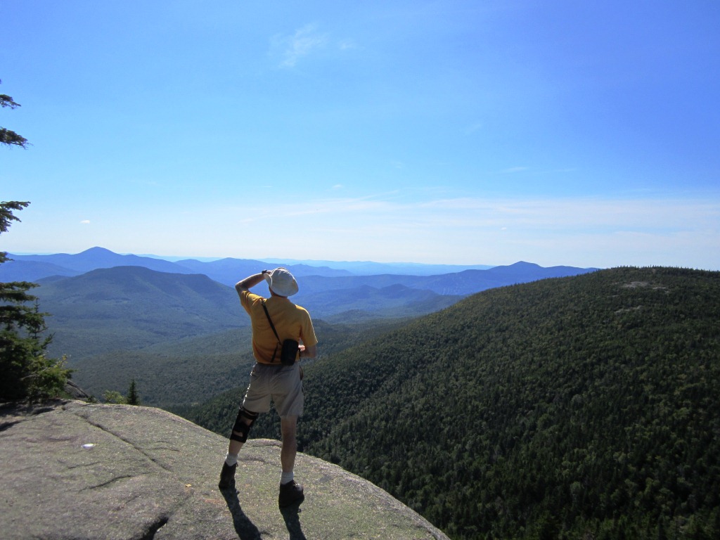
The views from the top of Stairs at 3,500 feet were again wonderful (left and right). Let me say here as an aside that the hike to Stairs and back, with detours to Mt. Crawford and the Resolution ledges, is in my opinion one of the very best moderate hikes in the Whites (~ 7 hours) and no one knows about it. As we climbed up to Stairs we met a couple coming down (first people we had met that day). They had camped at the top and extolled the view at sunrise - I can imagine.
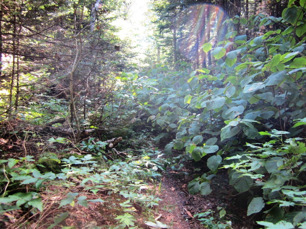

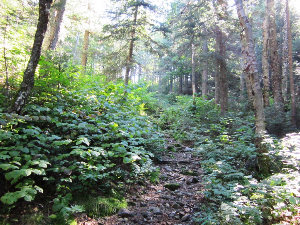
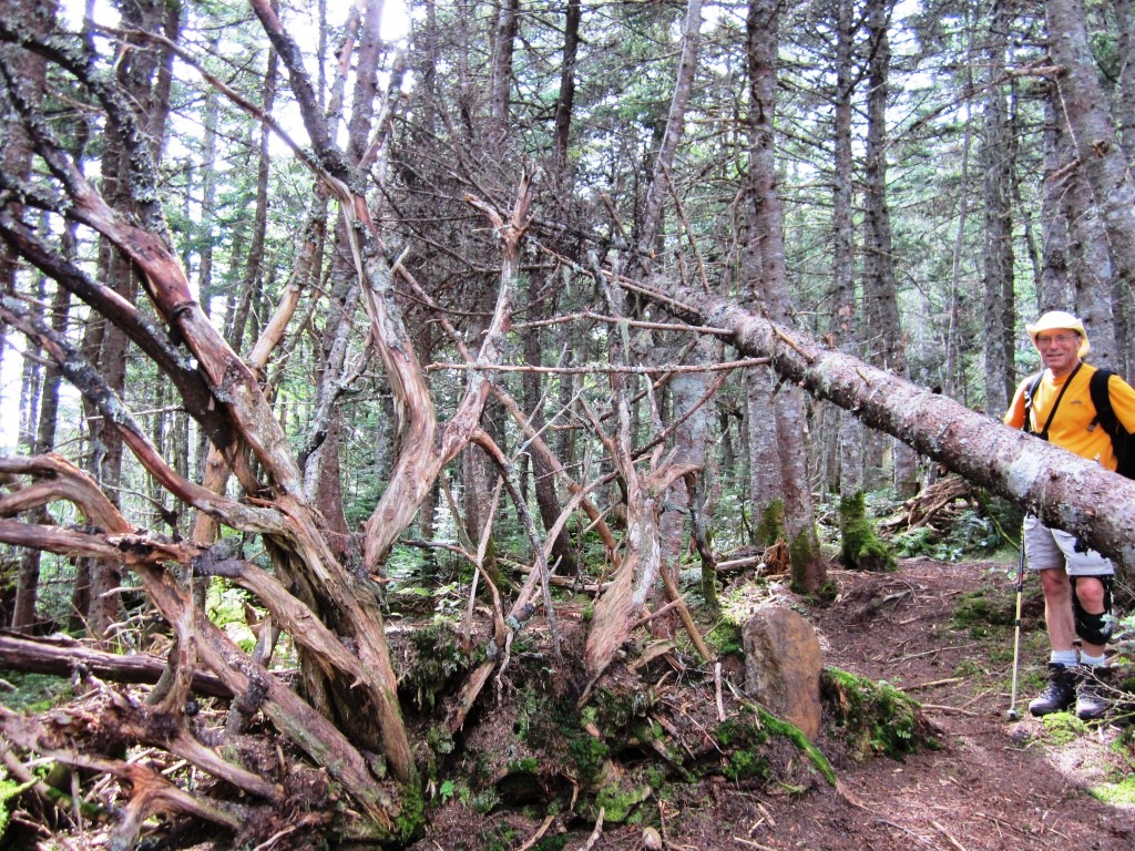
After enjoying the views from Stairs we got back to the Davis Path and on to Mt. Davis. We were now quite officially in the middle of nowhere. From Stairs Col the Davis Path goes for 6.6 miles without crossing another trail - that may be a record in the Whites. It's not as flat as one might think from the map - it goes down to a 2,900 feet col and then back up to reach Mt. Davis at 3,800 feet. It is described in the AMC Guide as "little-used, wild, rough, and overgrown" - enough to make one hesitate! But it's really not bad. You can't really get lost since you follow the ridge. The trail was overgrown in the col because of the luxuriant vegetation (left) but you just need to watch for the tread below. And you get the wonderful feeling of being in a place where people don't go (right - "Smile Peter! You're in the middle of nowhere!"
We did cross one lone hiker on the path, who had camped just north of Mt. Davis. He was as surprised to see us ("I didn't think I'd meet anyone on this path") as we were to see him. I love it when hiking is remote enough that you are just very pleased to see someone. As we got close to Mt. Davis we crossed a swampy area with "natural" bog bridges (left), which made me notice that this was the first sign of active trailsmanship that we had seen since Stairs. And then finally we saw the sign for the Mt. Davis spur trail, an exciting moment (right - it's in the shadow in the middle of the picture).
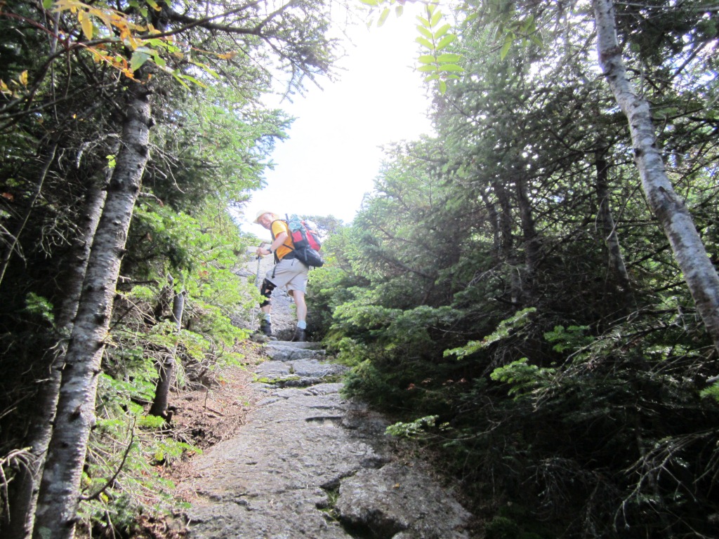

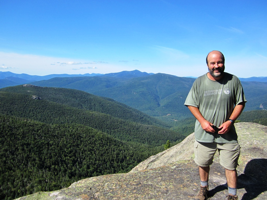
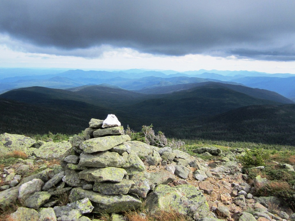
The spur trail is a 200 feet steep climb (left) with some scrambles - Mt. Davis does not give up easily! And finally we were at the rounded top (right). The top is indeed a 360 degrees view, as described in the guide, because for some reason the spruce are reduced to scrub. Let me get out of the way so you can appreciate the view towards Oakes Gulf and Mt. Washington (below left).

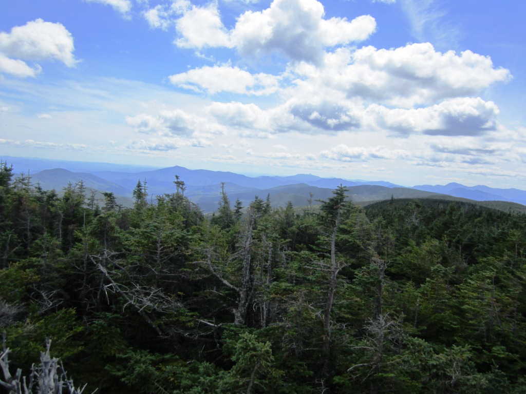
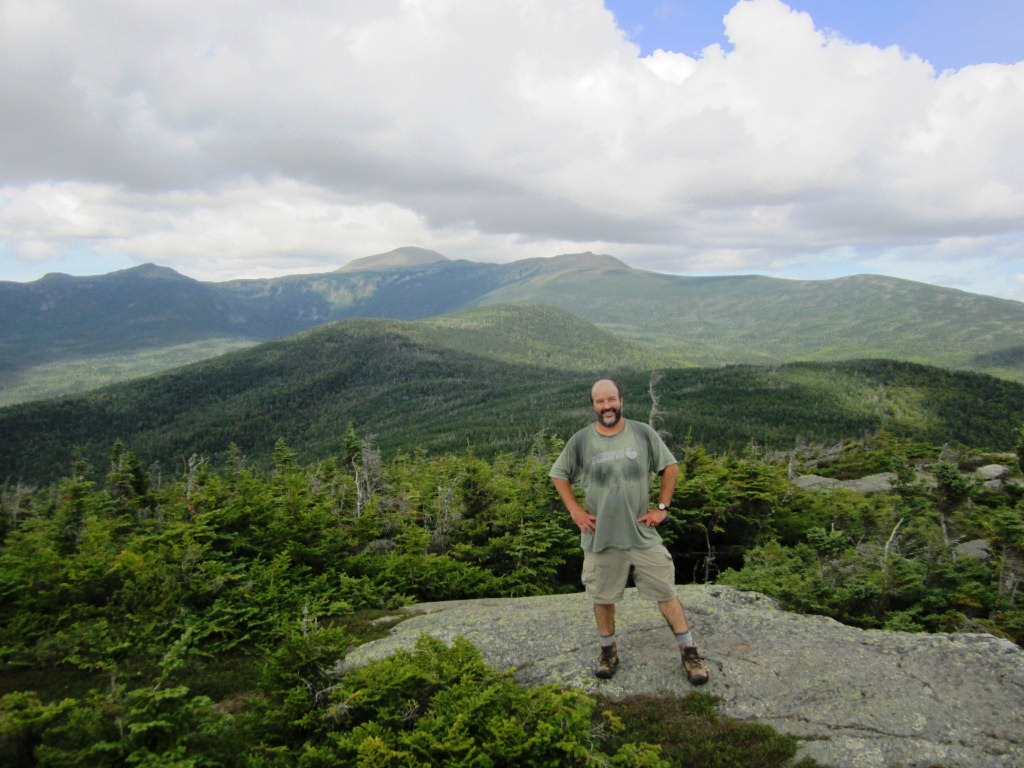
The view from Mt. Davis is indeed very nice, but I wouldn't call it one of the best in the Whites - maybe my expectations from the guidebook were too high. One major drawback is that you have to stand to get the view. To the south was a ripple of mountains (right), where you can recognize Carrigain and Passaconaway but they all seem pretty far. Maybe the midday light didn't do justice to the views. In any case, we were happy to have conquered Mt. Davis but also agreed that it was a bit of a letdown.


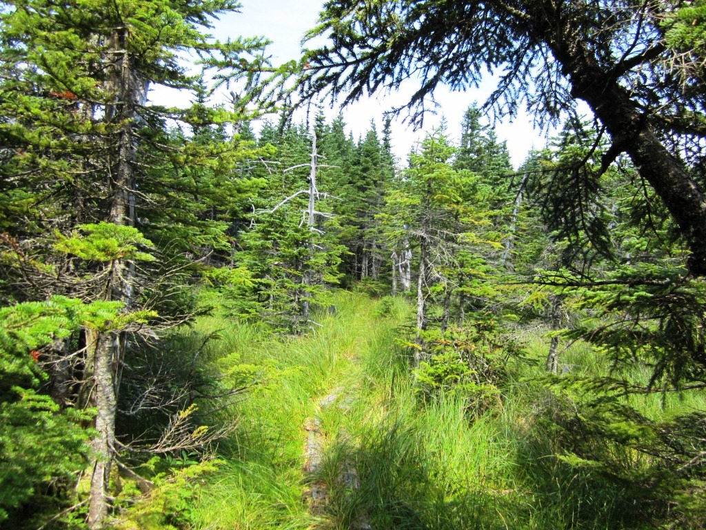
Since the top of Davis didn't have sitting views, we dropped to a ledge just below for lunch. There we had great view of the Dry River valley and the back side of the southern Presidentials (left). Peter and I have long mused about going into the Dry River valley, or dropping into it from the Presidentials, but it hasn't happened yet. The trails in the valley have been closed since the damage done by Hurricane Irene last year and this has put a damper on our plans. After our quick lunch we continued on to Mt. Isolation, and on that trail between Mt. Davis and Mt. Isolation you are truly in the middle of nowhere - there's absolutely no reason to be there unless you're doing the whole Montalban Ridge and few people do. Peter usually walks ahead of me, but here he strategically let me lead the way and I understood why - the trail was cobweb city (not much traffic!). My AMC volunteer sense is always looking for good trailsmanship, and I appreciated to see a few bog bridges though they were all in an advanced stage of decay (right). We also noticed a few spots where blow-downs had recently been chopped by an ax so the trail DOES get maintained.

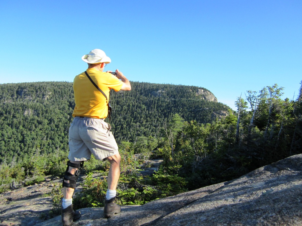
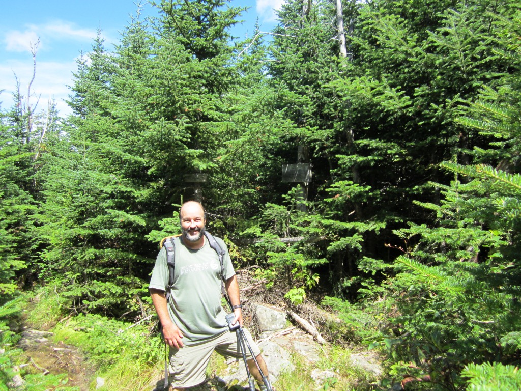
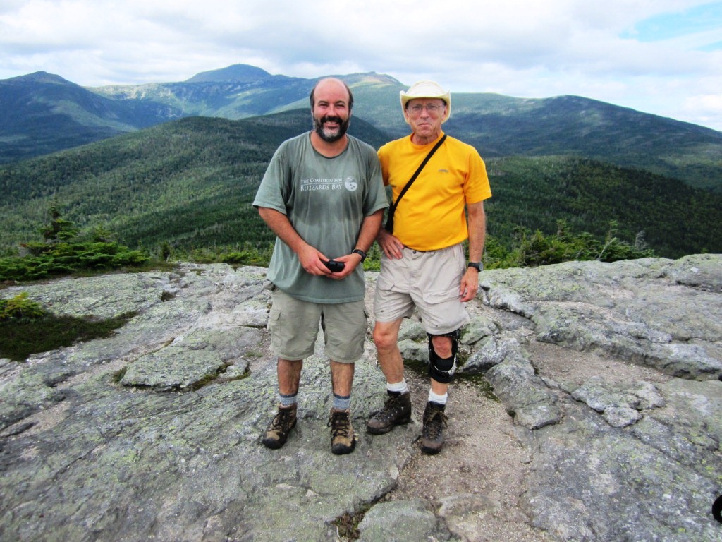
In this manner we got to the spur trail for Mt. Isolation (4,003 feet). This is considered to be one of the most isolated 4,000 footers and an ambitious destination; we had done it by the Glen Boulder Trail three years ago. But this time it was just a small side trip for us, a little bump on the ridge. Mt. Isolation does have a great, almost 360 degrees view (sitting!), and the view to Oakes Gulf and Mt. Washington (left) was in our opinion better than that from Mt. Davis because closer. This being a 4,000 footer we expected to see some people, and indeed a hiker trotted up for whom Isolation completed his 4,000 footers (right). We were delighted to see him so that he could take our group picture (below left).
From there we continued on, with the next stop to be above treeline. The Davis Path drops from Mt. Isolation to 3,700 feet (necessary col for Mt. Isolation to be recognized as a 4,000 footer) and then up to Boot Spur at 5,500 feet, with treeline at 4,800 feet. After the remoteness of the Davis Path between Stairs and Isolation, we felt we were on a highway - the trail was wide and well-maintained, a statement to the 4,000 footer traffic, and indeed we crossed two groups headed to Isolation. At some point we passed a toppled tree with huge roots (right).

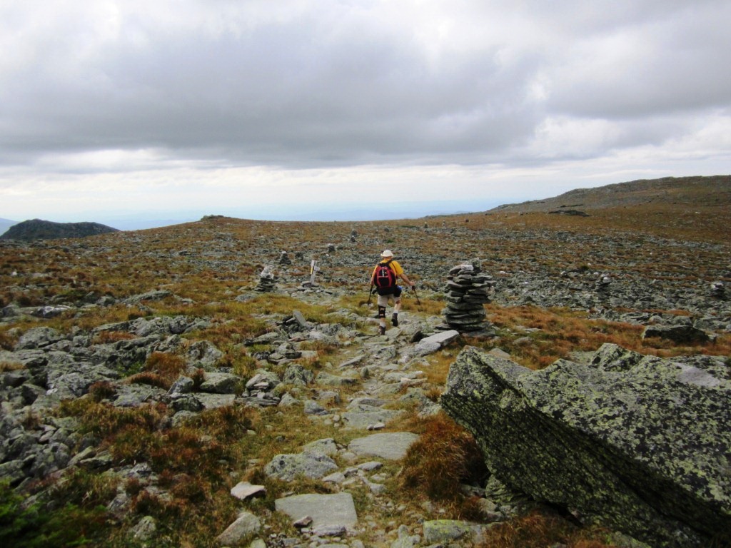
The climb to treeline was tough, as my legs were getting tired. Finally we broke above treeline to reveal a sea of mountains stretching beyond Montalban Ridge to the south (left). This, my friends, is my vote for the best view of the Whites. I had previously commented on that view when we had done the Glen Boulder Trail to Mt. Isolation. As we climbed above treeline the trees quickly vanished from view, and we climbed on the grassy-rocky slope up Boott Spur at 5,500 feet (right). Blueberries and cranberries were everywhere, and mixing up the two made a great snack - the sweetness of the blueberries compensating for the tartness of the cranberries.


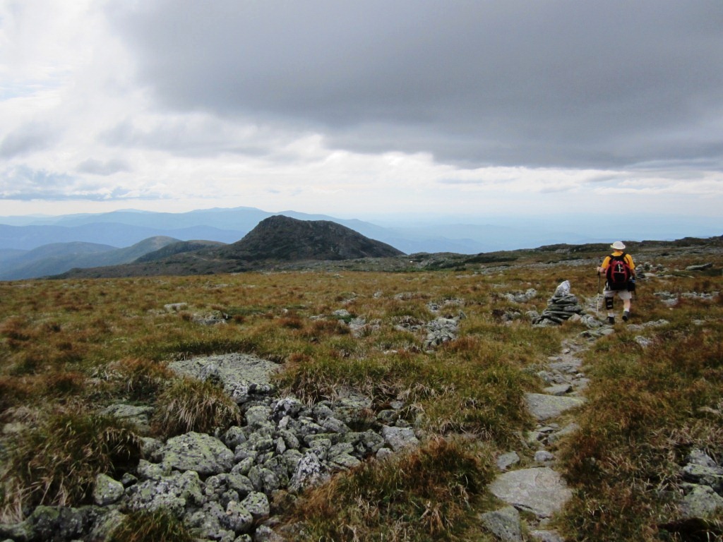
From Boott Spur we continued on the Davis Path along the edge of Tuckerman Ravine (left). Fog was rolling in and out which added to the magic of the place. When the fog rolled out we had the imposing mass of Mt. Washington in front of us (right). It was 5 pm by now and we crossed a few groups having climbed Mt. Washington and heading down Boott Spur trail back to Pinkham Notch.
We reached the Camel Trail and turned left amid the beautiful above-treeline plain of grass and rock stretching into immensity (left). The trail took us to the Lakes of the Clouds hut along nice views of Mt. Monroe (right). I had red-lined the Camel Trail just that past week and here I was on it again. As I pointed out in my report from last week, these flat meandering trails above treeline get very little traffic because of the obsession of hikers to go straight to Mt. Washington and yet there's no better way to appreciate the special feeling of being in the above-treeline world. Count me as a big fan of these trails - see for example my previous Alpine Garden hike.
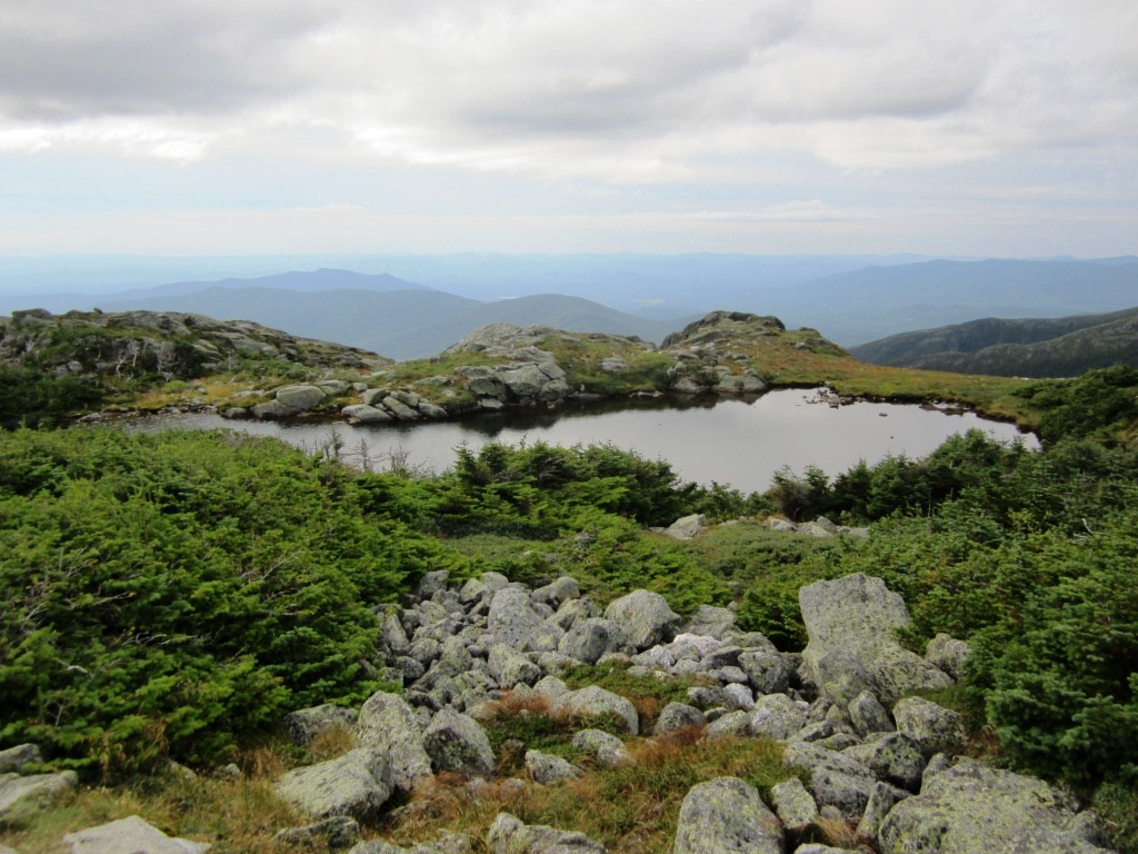
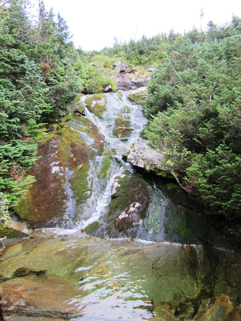
We thus arrived at Lakes of the Clouds and I realized that we had not seen water all day - Davis Path is a very dry hike, so unusual for the White Mountains. So I took a picture of one of the lakes (left), first documented by Darby Field in his historic climb of Mt. Washington in June 1642. The hut was busy with people getting ready for dinner. I rushed in and downed three glasses of the sickly-sweet lemonade that they have for sale, and abuzz with this sugar high I was ready to go down. We powered down the steep Ammonoosuc Ravine Trail, following the headwaters of the Ammonoosuc River (right - hey, more water!), and 75 minutes later arrived at the Cog Railway parking area. It was 7 pm and Nancy came to get us. A hike to remember!
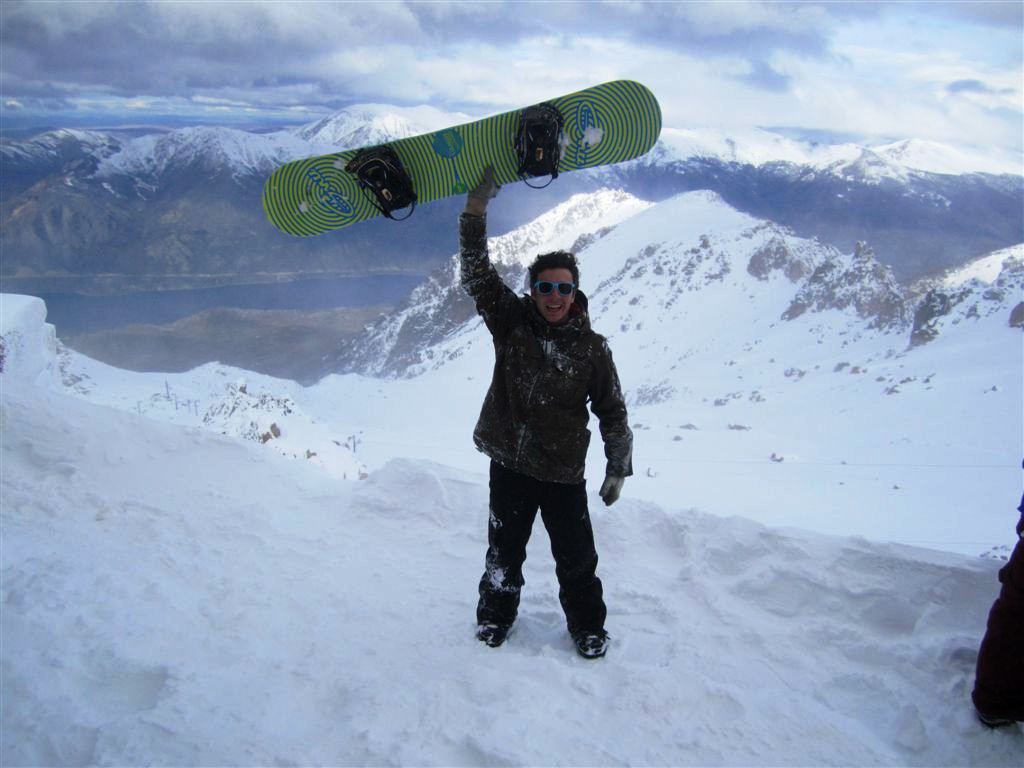
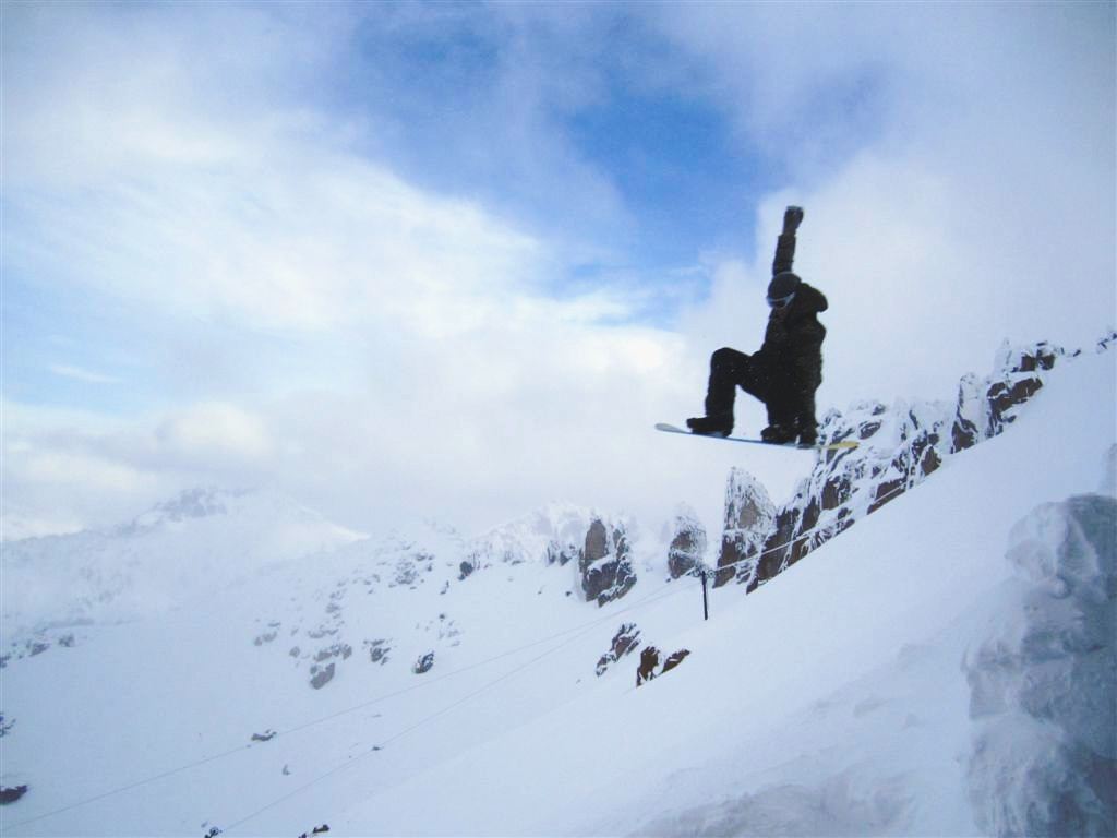
That same week-end Oscar was in Bariloche, enjoying his fall semester of study abroad at Buenos Aires (left and right). I'm so proud to have a kid dedicated to his classes. I'm sure that this was just a quick snowboard break between two intense study sessions.